Remote: far away in distance, time, or relation – not close.
28 Feb 2025
By Janine Jaffrey, Nature Trust Stewardship & Technology Coordinator
This January, for this first time, we asked Property Guardian Kristian Rafuse to help the Stewardship Team with a new method of monitoring: inspecting satellite imagery of our conservation lands, a method which is also known as remote monitoring.
The Canadian Land Trust standards and practices require that Land Trusts monitor all of their properties at least once annually, to ensure that they truly are protected forever. Despite our growing number of wonderful Property Guardians and additional summer stewardship staff, we still struggle to visit every property in-person and on foot – especially as the number of properties in our care continues to grow! Unsurprisingly, the majority of these properties are remote coastal islands, though we did have one washed out access road, and a bramble-topped peninsula near Cape North that we couldn’t make it to…
In 2024, our volunteer Property Guardians reached a new ‘personal best’, by monitoring a whopping 70% of our properties. Stewardship staff visited a further 25%, leaving just 5% of our conservation lands – about 1650 acres – that were not visited in person. This is where the new technology of remote monitoring comes in!
To acquire high-resolution satellite imagery, the Nature Trust has a subscription to a web based application called Lens, which is run by a company called Upstream Tech. Through this subscription, stewardship staff can upload our property boundaries and Lens will filter through all of the available high-resolution imagery taken by satellite networks that pass over Nova Scotia, such as WorldView Legion, Planet SkySat, and Airbus Pléiades. Once filtered, this high-resolution imagery is available to purchase.
Before purchasing any high-res imagery, stewardship staff consider what aspects or features of a property they want to be able to see; for example, to visualize the outline of a trail system or ATV tracks, it is best to look at imagery in the winter months when there is no tree canopy to block the view underneath, or when there has been a light snowfall that highlights the linear features of the tracks. Contrastingly, summer imagery showing an intact tree canopy (and its shadow) is needed when a neighbouring property has recently been cut, to see if there has been harvesting encroachment onto Nature Trust lands. This seasonality of the image also influences the amount of shadow that is cast by tall features, where there are more in winter due to the sun sitting lower in the sky. Likewise, clouds will cast shadows over the property, potentially obscuring areas of interest.
The spatial resolution of an image refers to the area covered on the ground by one single pixel. For example, the European Space Agency’s Sentinel 2 satellite network captures imagery of Nova Scotia at a 10 meter resolution every week, so each pixel in their images covers a 10 x 10 meter square on the ground; this resolution is considered to be relatively ‘course’, as no on-the-ground details can be identified in these true colour images.
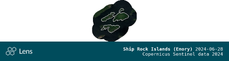
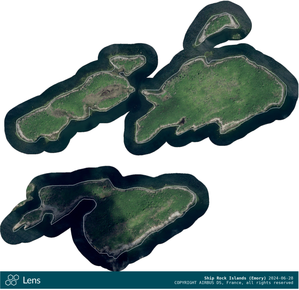
The high-resolution imagery that the Nature Trust purchases ranges from 1.5 meter to 0.3 meter resolution, where each pixel in the image represents 1.5 m2, or 30 x 30 cm on the ground, respectively. The image below is of the Ship Rock Islands on the Eastern shore, captured at a 0.3 meter resolution:
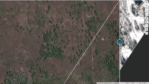
Once a couple images of a property have been purchased, remote monitoring can begin. The Lens interface has a ‘slider bar‘ that can be moved horizontally back and forth across the screen, allowing two images of the property, taken on different dates, to be layered on top of each other. The monitor will zoom into a small section of the property and then use the slider bar to look at both images simultaneously, essentially playing a high-tech game of Spot the Difference. Human-created features are typically very obvious, as they are either linear, like the straight lines of ATV tracks, or perpendicular in nature, like the 90 degree corners of cabin roofs.
Seeing distinct straight lines or square edges in the middle of a Nature Trust forest, swamp, or coastline is unusual, so features like this are flagged by the monitor. They drop a pin on the image, or outline the entire feature; these pins and outlines are georeferenced in Lens, and then Lens will automatically send a copy of the imagery and the location over to the Landscape Database. That way, when a Property Guardian next opens up the Landscape monitoring app in spring 2025, a new red Issue point or outline will have appeared on the Landscape map. When the Property Guardian (or staff member) manages to visit the property, they can go and look at the feature in person, to ‘ground truth’ what was seen in the satellite imagery.
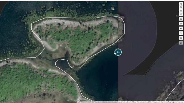 For his first time trying remote monitoring, Kristian did a great job! One particularly impressive observation was of a light coloured rectangular shape along the southern shoreline of one of the Ship Rock Islands. In taking look back at the 1998/99 photo baseline, this exact location was highlighted as small area that had been cut and cleared, and was described as a historic hunting campsite; this particular spot hasn’t been visited by staff in 15+ years, but it certainly will be in 2025 due to Kristian’s keen remote monitoring observations!